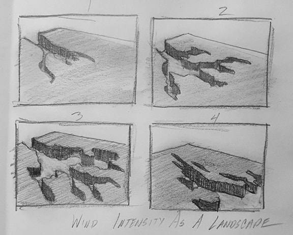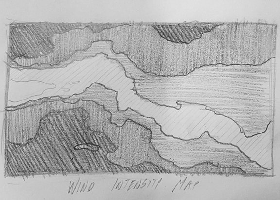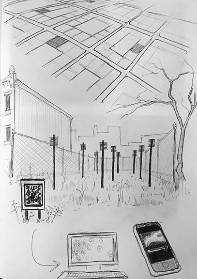
 Lauren Ken and I have been exploring several concepts that we find interesting and discussing how we can put them into some form of ecological art (art that solves ecological problems, and we want it to also provide ecological data!). One idea that I’m really jazzed about is thinking about how to create prairie restorations in a way that has artistic concept behind it. When restoration ecologists typically seed a prairie, they first choose a seed mix that is native, and often that is heavily weighted towards forbs (think: wildflowers, anything that is not a grass) because grasses can dominate in restored prairies. Then, these seeds are scattered as homogeneously as possible throughout the sites. Here is a picture of one of our Iowa State undergraduate English students helping us seed the prairie in the typical way. However Ken and I discussed for a long time, what if you could plant a prairie in a way that changed through time (within a year and across years). We both agree it would be really neat to design a prairie restoration with an artistic concept in mind, but then see how the prairie “picture” evolved through time. There could be really straightforward data to collect, including does this artistic prairie function in the same way as a typical prairie – for example, does it have the same soil qualities, or does it support the same communities of insects and pollinators? We could also ask really interesting social science questions as well, about how well do local citizens connect with the prairie, and concepts related to native landscapes and conservation, and does that change depending on if the prairie has an artistic edge to it or not. 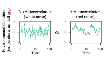 What the artistic concept could be, we have not yet decided. We are currently thinking about a bunch of really neat themes. One for instance, is stochasticity, or the balance between randomness and knowingness. I love the idea of random, and thinking about the different kinds of random (yes, there are different kinds of random… and random things can be autocorrelated in different colors - which have different sounds!) Another concept we talked about was erosion. So Ken likes the idea a lot, and mentioned that if you take a picture of something, then save it as a .jpeg (I think this is the file format…), take a picture of it, then save it as a .jpeg over and over – eventually your image will erode completely to be a gray blur. This is super interesting to me! And we began thinking about how our “image” in the prairie might erode through time via dispersal and colonization, two things I really like to think about! We are thinking more about these cool concepts this week, and will have an interesting discussion about which ideas to incorporate and how soon. Blogged while listening to Michael Kiwanuka (especially the first half)  Altitude Sketch Altitude Sketch Ken During the last conversation with Lauren, it became apparent that we needed to follow an idea that would allow her to research and provide me with material (data or physical object creation.) While we are still compiling a list (includes very general topics such as randomness, erosion, generation loss, colonization, wind pattern, etc.) our conversation came back to restocking grasslands- the idea of intervening on a current space and bringing it back to its natural state with native plants. Lauren informed me that there is debate in this as well- what/ when is the true natural state of that area. Would that be Colonial time period, Native American time period, or post glacier or even further back? What species of plants were prolific and present? Which were recent ‘invaders’? At what point would you target in the natural evolution of this ecological system? The effects of humans on the environment are many fold- among them was how the land was used/ affected during that period of society and was it documented, if even possible.
0 Comments
Leave a Reply. |