|
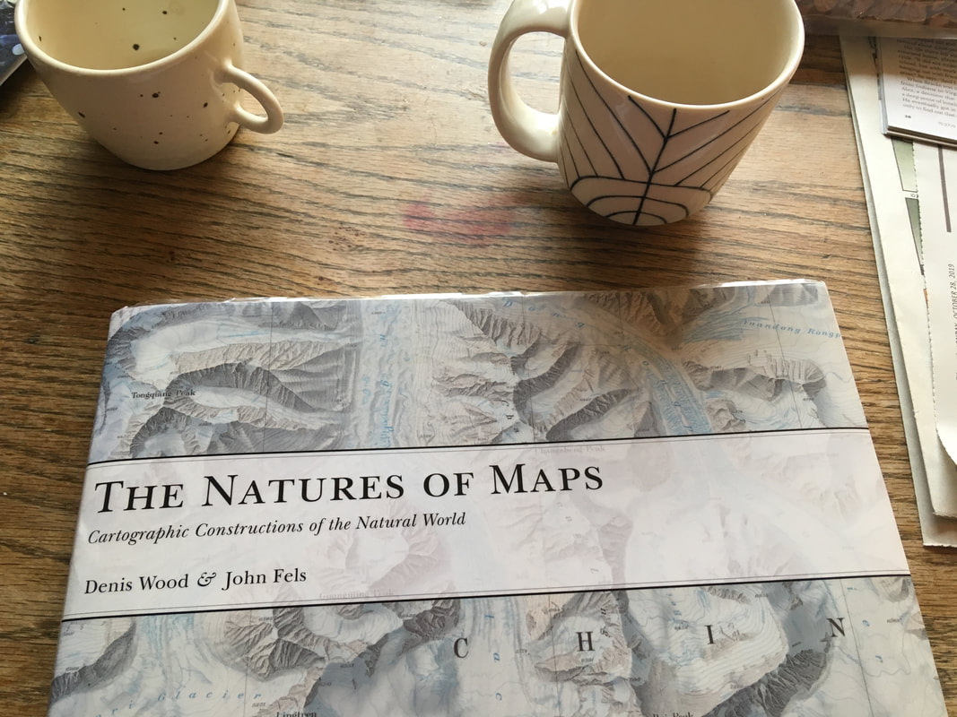
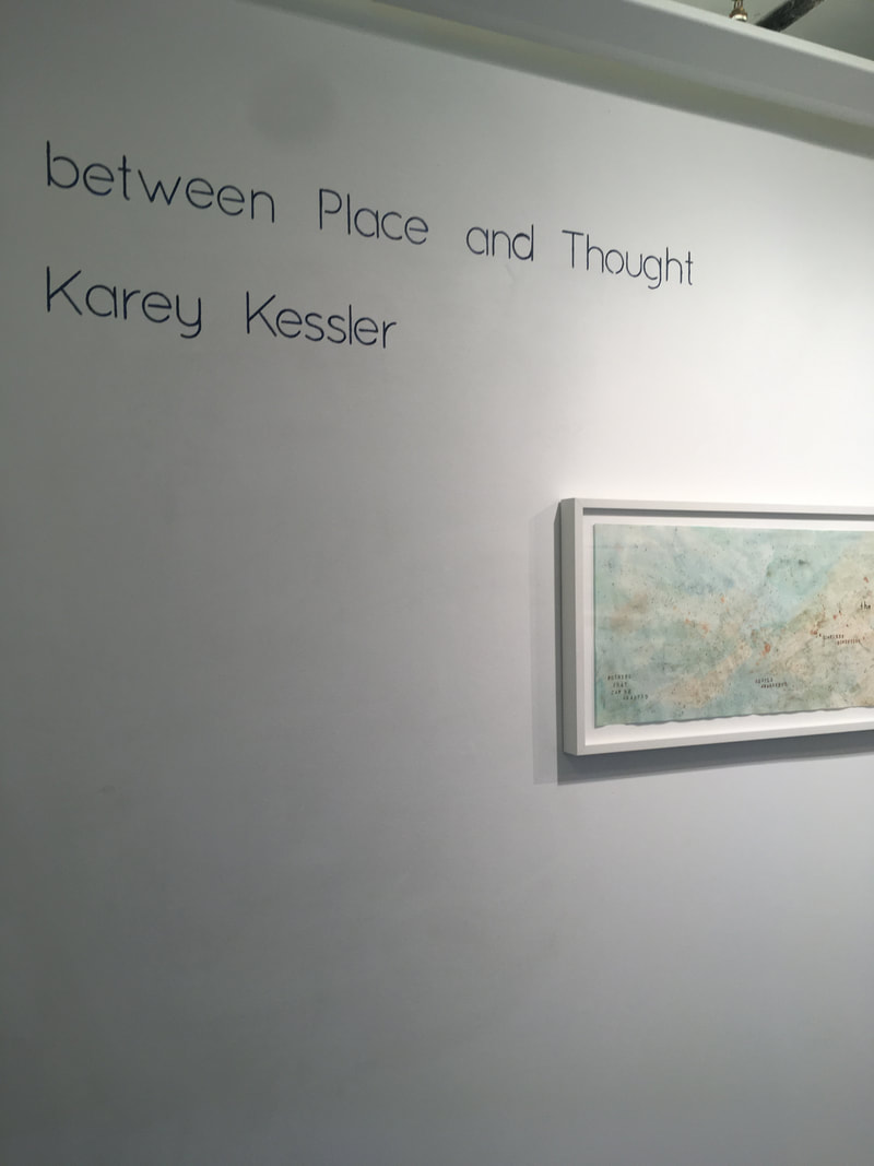
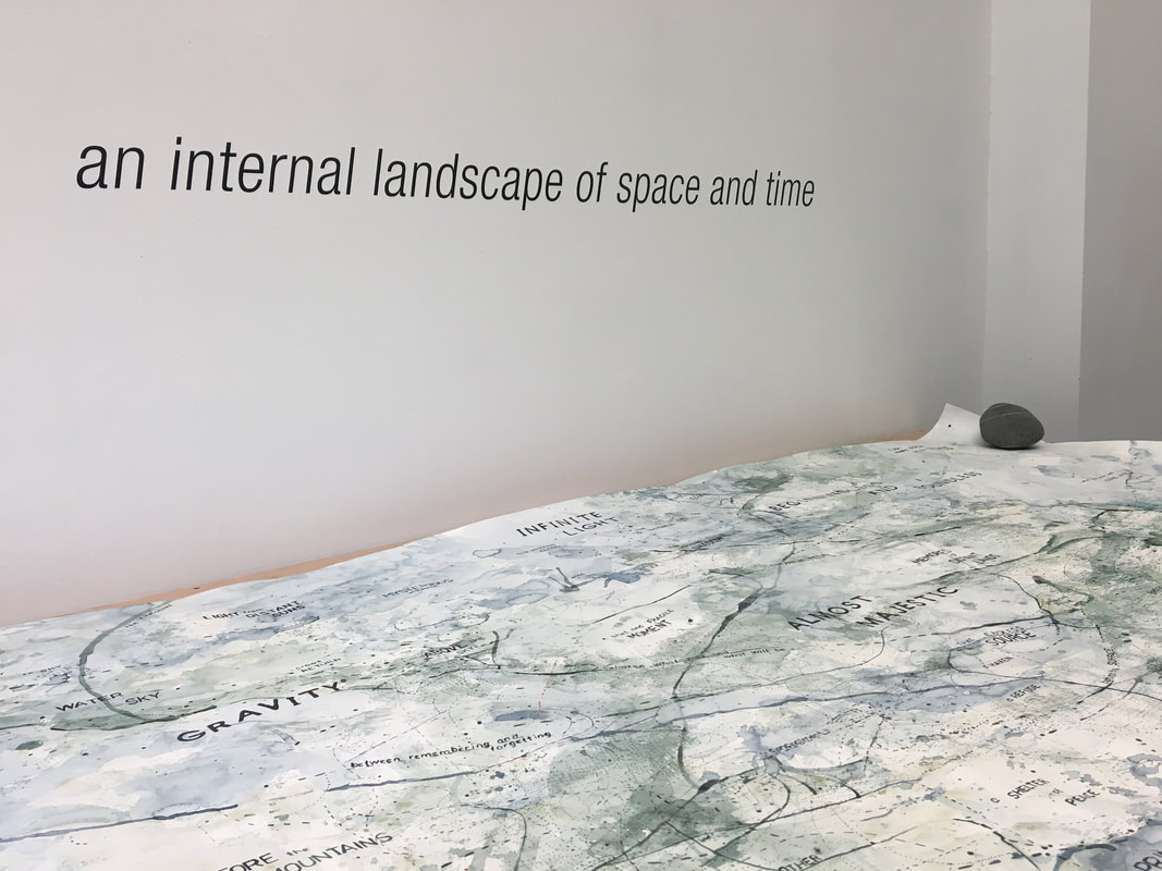
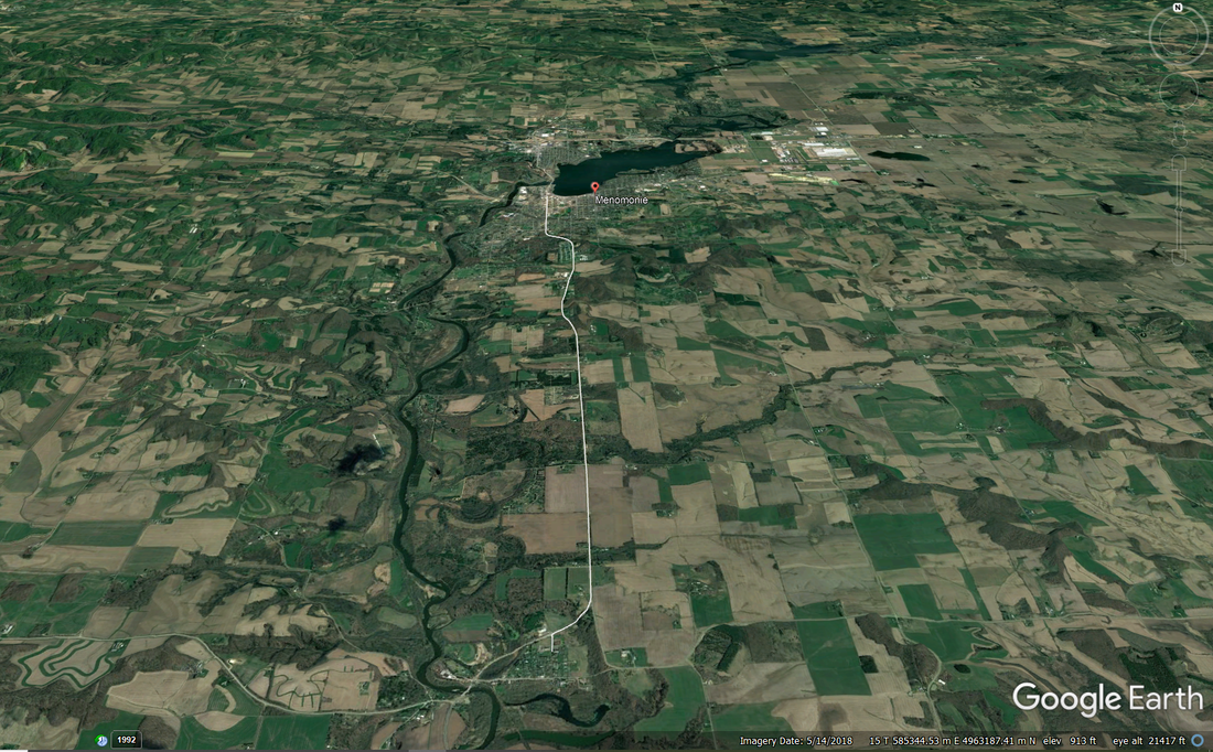
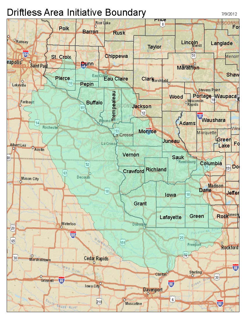
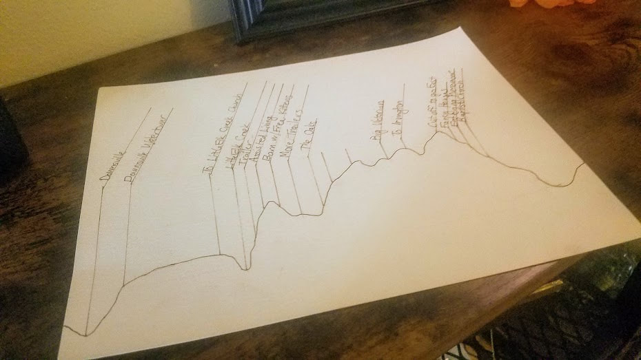
Karey A few weeks ago, Innisfree reminded me of the writer and map enthusiast, Denis Wood. I read a few of his books when I was in graduate school and was just beginning to think about maps as a form of abstract art. Back then, Wood’s books provided me with somewhat of a bridge between real-world maps and maps as art because he, too, is interested in mapping the unmappable (or, at least mapping things that haven’t been mapped before). So, I decided to revisit Denis Wood’s writings and took out a few of his books from the library: In his book, The Natures of Maps Wood writes about maps as socially constructed arguments with subjective perspectives as opposed to being objective representations of the world. This is something Innisfree and I wrote about in our second blog posts and is one of the topics Innisfree writes about and studies in her work. Wood also writes about psychogeography, or cognitive cartographics — the geography people carry around in their heads. The idea of mental mapping is particularly interesting to me because I think of my map paintings as “mindscapes” or “inscapes.” In chapter one of The Natures of Maps Wood quotes the cognitive linguists Gilles Fauconnier and Eve Sweetser as saying: The basic idea is that, as we think and talk, mental spaces are set up, structured, and linked under pressure from grammar context and culture. The effect is to create a network of spaces through which we move as discourse unfolds. I love the mental image of moving between language and space as we think about and experience the world. Curious, I looked up “cognitive mapping” and that led me to the research of neuroscientist John O’Keefe and his Nobel prize winning work on stem cells and our experience of place. I watched this whole one-hour lecture on how your brain maps the world. He’s an excellent teacher and it was relatively easy to understand (on an artist’s level). Towards the very end of his lecture, O’Keefe talks about how both memories and our sense of place are formed in the hippocampus. This led me to muse about how I’ve been trying to paint the connection between memory and place in my maps. My show at Shift Gallery in Seattle last February was titled “between Place and Thought”: As I continued researching the connection between place and memory, I came across this article, "The tangle of space and time in human cognition," by Rafael Nunez and Kensy Cooperrider. It’s about how humans also conceptualize time in terms of space. It’s pretty dense, but I was drawn to the main idea that, “the mapping between time and space is about underlying thought, and not just surface linguistic expression” and how there is a deep neural bases for spatial and temporal conceptualization. Our experience of the “here” and the “now” is inseparable. So, with all this extremely dense scientific material in my head about our cognitive experience of “place,” “time,” and “memory,” Innisfree and I are embarking on a much more hands on artistic approach to cognitive mapping by creating map-poems of where we live. This exercise will give Innisfree the opportunity to use some of her art materials and it will give me the opportunity to map a more specific place (where I live) instead of an abstract space. We’re working on the parameters (size, materials, etc.), and hopefully we will start creating our map-poems this week. Perhaps, once we see each other’s maps we’ll trade ideas and be inspired to create more. Innisfree So, this week Karey and I agreed to start working on an exercise created by Lisa Charlotte Rost during a talk for NACIS (the North American Cartographic Information Society) in 2016 called map poetry. I discovered this exercise through another NACIS talk, Creating Space to Create: Teaching technologies you don’t know, given by Ashley Nepp at Macalester College on teaching cartographic technologies then you can’t keep up with all the new innovations yourself. This is a major problem in many scientific fields, we are inundated with data and technological innovations and it is very difficult to keep up. A first step to getting started is to get students comfortable in being “a beginner” is to get them comfortable with being vulnerable with each other, but also being willing to accept critique in the spirit of continual improvement rather than competition and the threat of failure. This week I’m struggling with being a beginner. I went to the local art supply store in our small town and asked the owner to help me pick out some arts supplies to allow me to start working on a hand made map of my experience in day to day life. I bought some brushes, paints, and paper. But, I have reverted to my reliance on the digital to get me started. Every day I drive seven miles from home to downtown Menomonie where the UW-Stout campus is. If you view the road I travel on most maps, it appears straight and boring, mostly traveling through monotonous fields of corn and soybeans. But, I actually live on the edge of what is called the Driftless Area, the one part of the Upper Midwest that wasn’t covered by glaciers during the last glacial maximum. Because of this it is hillier here, reflecting the topographic variation, hills and little valleys carved by the slow erosion of streams and rivers, that existed before the glaciers arrived to gowned down the entire region. When we moved to this area, my husband had already become sick with rheumatoid arthritis and had significant mobility issues because of joint damage and the need for a knee replacement. So I was looking for a house or apartment that was on one floor and had an attached garage so he won’t have to risk slipping on slick walkways to get to the car in winter. The place I found was in a small village seven miles from the city of Menomonie. Much of the housing in town was built prior to the widespread adoption of the automobile, so garages tend to be separate if they exist at all and most houses are multistory with bedrooms on the second floor. So I have ended up with a short commute, rather than being able to walk or bike to work. This 10-15 minute journey between the village of Downsville and the city of Menomonie features prominently in my day-to-day experience of life here. In this case, it is the vertical variation that marks the trip, so working in Google Earth, I constructed an elevation profile of my trip which I then attempted to draw. I haven’t even gotten started trying to add paints or colors to the drawing. This is just a start and rather a literal one, but at least featuring the parts of my daily trip that stand out for me. I would like to create vignettes, for various locations… I’m excited to see what Karey’s local area is like and how she perceives it.
0 Comments
Leave a Reply. |

