|
Karey Innisfree and I were unable to connect through Google Chat this week because of conflicting schedules. But, we’ve continued through texts to share our ideas about maps and abstract art and also to brainstorm ideas for possible mutual projects. I think the best (and most helpful) thing for me to write about this week is a list of some of the things we’ve been throwing around and thinking about. 1. Innisfree told me she’s particularly interested in exploring “uncertainty” and maps. We haven’t discussed what aspect of uncertainty she’s referring to, but I love the weight of the word itself and it showed up in one of my maps this week: 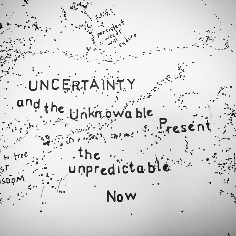 2. We were both musing separately about satellite and aerial images. Innisfree is interested in using them as a launching point for exploring abstract art (something I already do) and I was thinking about the question: can a photo be a map? 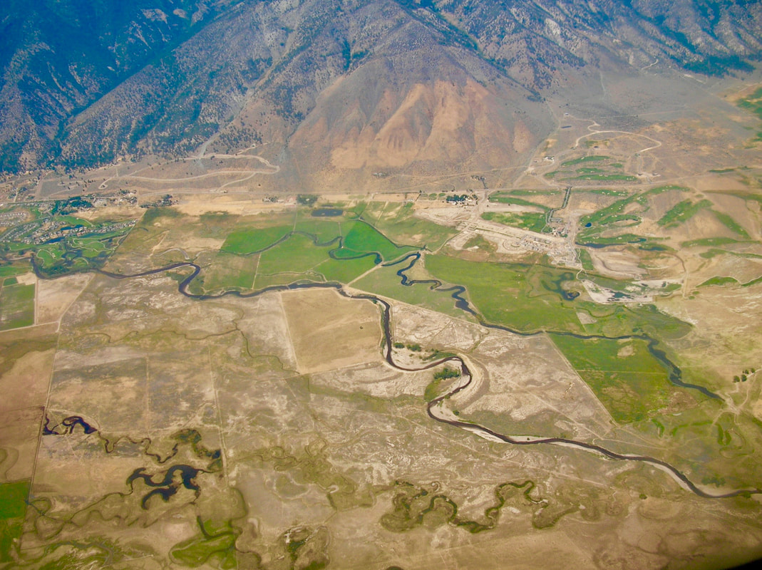 A photo I took from an airplane window This question and others arose from an excellent TED talk I watched about maps and Google Earth: Gopal Shah - how maps shape our world view. We live in a world that is mapped all the way from outer space right down to our front doors. We can look at 3D cities, 360-degree views of most locations, and even a photo of the cosmic view point of planet earth. Part of why I use map imagery is to counteract the hyper-mapped world we live in. To subvert our sense of knowing exactly where we are and instead asking why we are here. 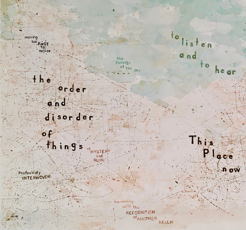 3. Another thread of conversation Innisfree and I had this week was about learning more aspects of each other’s work methods. What I find intuitive and easy (thinking of map patterns as abstract and open to interpretation; using watercolor and other art materials; talking about abstract art) Innisfree finds complex and difficult. And what I find immeasurably hard (GIS, computer programs, statistical interpretation of data) Innisfree finds natural and somewhat obvious. I shared, with Innisfree, this website, maps and cartography, about map artists so she could explore a wide range of abstract artwork dealing with maps. I also plan on sharing my knowledge about different paints and pens and inks and paper so she can try creating some abstract maps on her own. And Innisfree shared a website with me about creating hill shade for hand drawn maps. She also mentioned the possibly of teaching me more about GIS/cartography principles and about sprawl patterns so that we might be able to come up with hands on projects for some of her students. 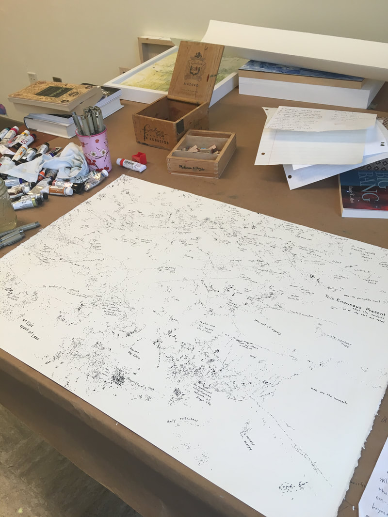 A map I’ve been working on this week 4. I am particularly excited about this list that Lisa Charlotte Rost wrote in her Map Poetry blog post that Innisfree shared with me this morning. Serendipitously, many of the terms on this list are topics I’ve been googling this week - exploring the different ways we map the world. I plan on delving more into some of these topics next week: Map Poetry = mapping weird stuff mapping less obvious stuff mapping the unexpected psychogeography Human Geography Behavioral Geography Cognitive Maps Narrative Mapping Mental Maps Emotional Cartography Creative Cartography Geographical Imaginations The Map Poetry blog post emphasized to me, what I already know: that although I use cartographic imagery, my paintings are much more like poems than maps. Real-world maps simplify places in order to be more useful for getting “from here to there” and for knowing “what’s there.” My maps purposefully create more complexity and are void of specific geographic locations - focusing instead on an ambiguous network of memories, ideas about impermanence, and the immensity of time. Innisfree The last couple of weeks have been challenging in terms of schedules and getting together with Karey. One of the interesting elements of this partnership is that while Karey and I could both make images that look like maps of the world, the purpose and method of creation are very different. So, the task has been to find areas of similarity or overlap in our practices. Karey’s post on poetry helped me to think more about representation and how there might be more areas of overlap than I initially thought. While I certainly sometimes create maps, much of my research has involved other forms of representation of places, primarily through interviews with people about a place of significance to them but also through gathering other representations of the place under contention such as media clips, maps, photographs, tourism brochures, and even art. One of my major research interests is how people go about managing their land or shared lands, and how they make decisions about these important places. Understanding why people make the decisions they do and how conflicts emerge in terms of these decisions could be key in helping us understand how to make better, more sustainable decisions in the future. In my research, I attempt to take these many different and often conflicting representations of a place and weave them together to tell some sort of consistent narrative that communicates a story of the people and processes at work. 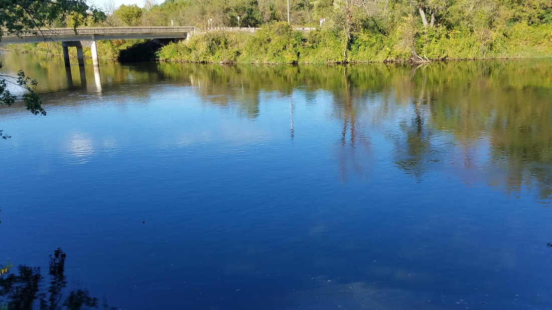 Sometimes you are just trying to capture the little things. To give a sense of what the experience of a place is. But, the reality of a place being studied isn’t one story, one narrative, it is many different processes, people, non-humans, etc, coming together to shape that place. When you attempt to summarize these and construct a single narrative, you are, simplifying, erasing, and leaving things out. In many fields there has been broad discussion of this process, of the scientist interpreting and simplifying phenomena under study, thereby missing important pieces. At the same time, the method you use to represent something being studied, also makes a difference, some things are more easily understood through a photo, or through a story or in people’s own words through a quote. I have been struggling a bit this week with the somewhat abstract elements to Karey’s art. I have been thinking, what does abstract art mean?
0 Comments
Leave a Reply. |
|