|
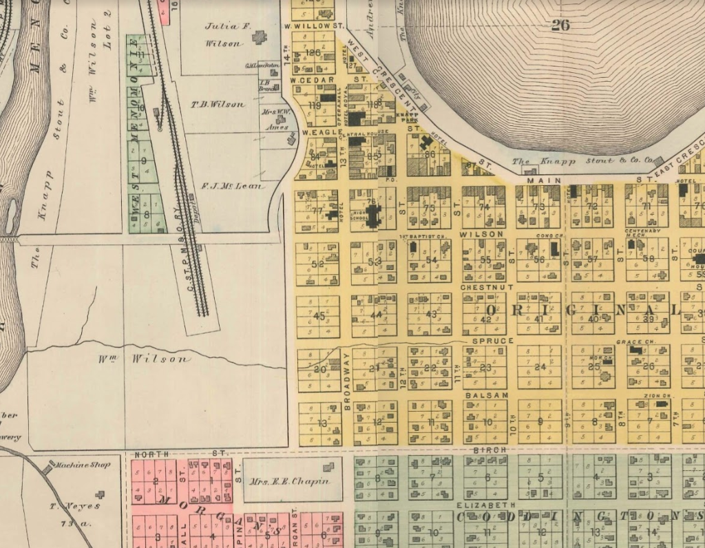
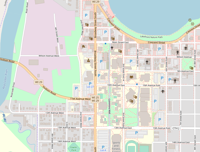
Karey This week, I spent time researching the history of my neighborhood. I plan to incorporate some of the information I gleaned into another map-poem. I found this wonderful website https://wedgwoodinseattlehistory.com about the history of part of the neighborhood I live in (Seattle is divided into many neighborhoods and my house touches three: Wedgwood, View Ridge and Ravenna/Bryant). This website has information and maps about the history of everything in Wedgwood: the trees, the gas stations, the schools and the streams. Most of the information is from 1954 to present day (since my neighborhood didn’t become part of Seattle City Limits until 1954 and before that it was sparsely populated). In order to find more historical maps of my neighborhood, I decided to go to the Map Room at the Seattle Central Library (surprisingly, I had never been):  The map room at Seattle Central Library The Map Room was open, but, when I spoke to the person at the circulation desk, she told me that they’ve recently moved all of the maps of Seattle to the Seattle Collection Room which contains items related to Seattle’s history - including maps and atlases. Of course, the Seattle Collection Room was closed that day. So, I plan on going back later this week. I also might visit the library at the University of Washington. They have a map room and I hope to borrow a map of my neighborhood (which includes the University of Washington) to trace and add to. Innisfree informed me that Washington State University has an online digital collection of early Washington Maps. I found a few beautiful early maps of Seattle that included my neighborhood. Seattle was officially founded by colonists in 1852, but up until the early 1900’s no colonists lived in my neighborhood. The oldest map I found is this map from 1855. It shows everything north of Yesler Way (which includes my neighborhood) as “hills and woods thronged with Indians”: 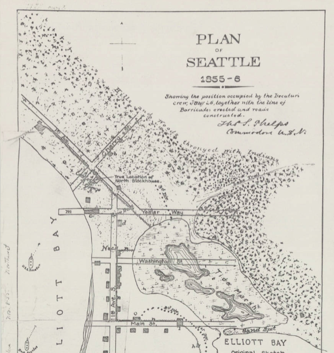 My neighborhood in 1856, credit University of Washington Libraries Special Collections. I was particularly drawn to this map from 1894 because of it’s depiction of the wetlands near my current art studio: 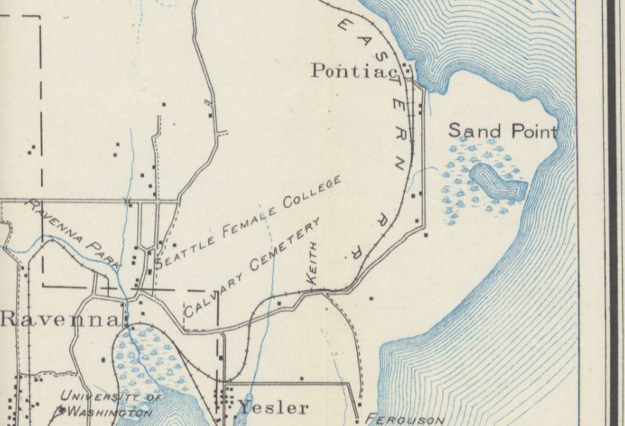 My neighborhood in 1894, credit University of Washington Libraries Special Collections Later, I was thrilled to discover that on the USGS Historical Topographical Map Explorer you can find specific locations (like my neighborhood), and then, using transparency sliders, overlay maps. I dragged the 1894 map with it’s depiction of the wetlands on top of a current map of my neighborhood: 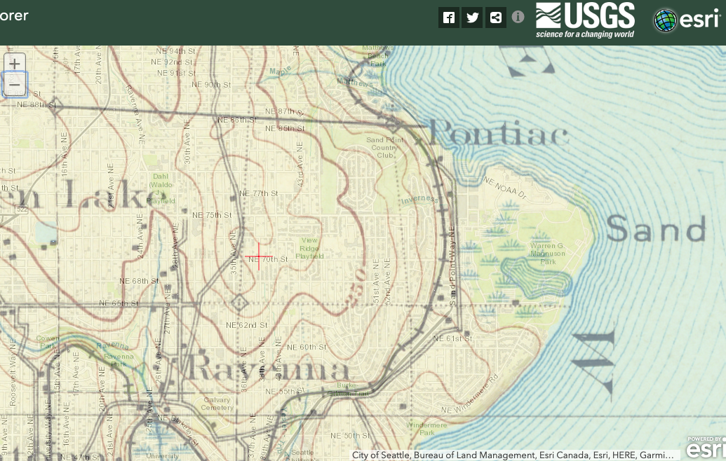 Taken from USGS Historical Topographical Map Explorer Then, I added a map from 1962 with a drawing of an airplane and an anchor where the naval base was during WWII (right on top of the wetlands). The cool thing is that naval base has recently been returned to wetlands through restoration - so, the image of the airplane overlaid on top of the wetlands in 1894 is both historically and currently true. 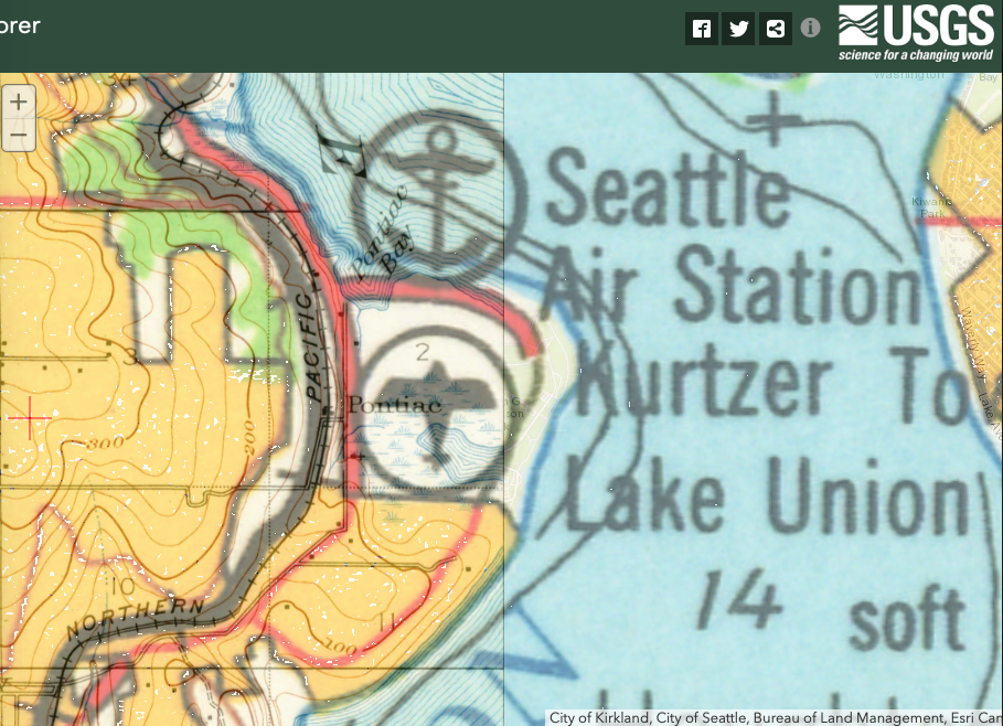 Taken from USGS Historical Topographical Map Explorer I’m excited about these USGS Historical map overlays and will definitely be playing around with them more - perhaps tracing them and then adding to them myself.
The other thing I have been researching in the history of our area is the relationship with native people. Menomonie means wild rice, and local leaders decided to call the dammed-up river next to the town Lake Menomin in a deliberate effort to evoke a certain romanticism associated with wildness and nature in order to replace the logging industry with money for the local economy related to tourism. In this brochure from 1965, you can see the way that imagery related to Native Americans is used to promote tourism and suggest the wildness or exoticism of the country while the text reassures potential visitors that the area has all the modern amenities. 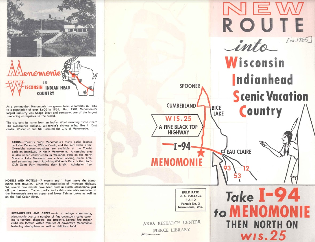
0 Comments
Leave a Reply. |


|